
The Bridges of Durham
From medieval masonry to modern steel and concrete, Durham’s bridges tell the story of the city itself.
Durham is a city shaped as much by water as by stone. The River Wear loops tightly around the historic peninsula, creating some of the most dramatic urban scenery in England — but also demanding a series of crossings that, over centuries, have reflected changing needs, technologies, and ideas.
Taken together, Durham’s bridges form a remarkable timeline of English bridge building, from Norman power and medieval commerce to Georgian elegance, post war engineering, and 21st century regeneration. Our map shows the location of all the bridges mentioned below.
Elvet Bridge: The Medieval “New Bridge”
Construction of Elvet Bridge began around 1160 under Bishop Hugh de Puiset (Pudsey). Built to connect the newly planned borough of Elvet with the cathedral peninsula, it was known in medieval records as the “New Bridge.”
Elvet Bridge is a substantial stone structure with 10 visible arches, though debate continues over whether additional arches lie buried beneath later street levels. Only one arch survives from the 12th century; most date from the 13th.
For centuries, Elvet Bridge functioned as a street rather than an empty span, carrying chapels, gates, shops, and even a prison. Flood damage — especially during the Great Flood of 1771 — led to major repairs, while widening in 1804–05 created the asymmetrical profile seen today.
The white numbers 1 and 2 are such a part of living in Durham - looking to see how high the river is by how far up the numbers it’s reached!

A view of the cathedral looking across the River Wear through the arch of Framwellgate Bridge

Framwellgate Bridge from the upstream side with Milburngate bridge in the background

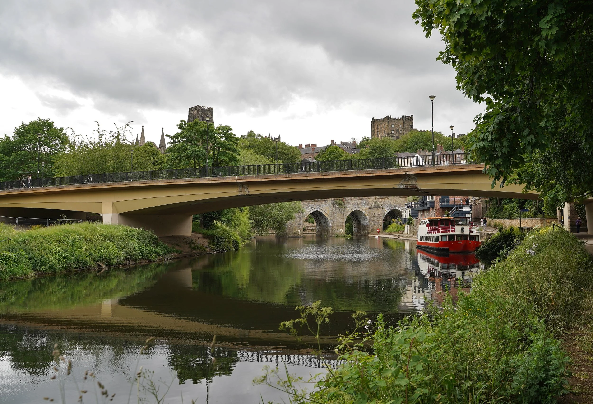
A view of Elvet Bridge from downstream in summer. The Prince Bishop river cruiser can be seen through one of the arches.
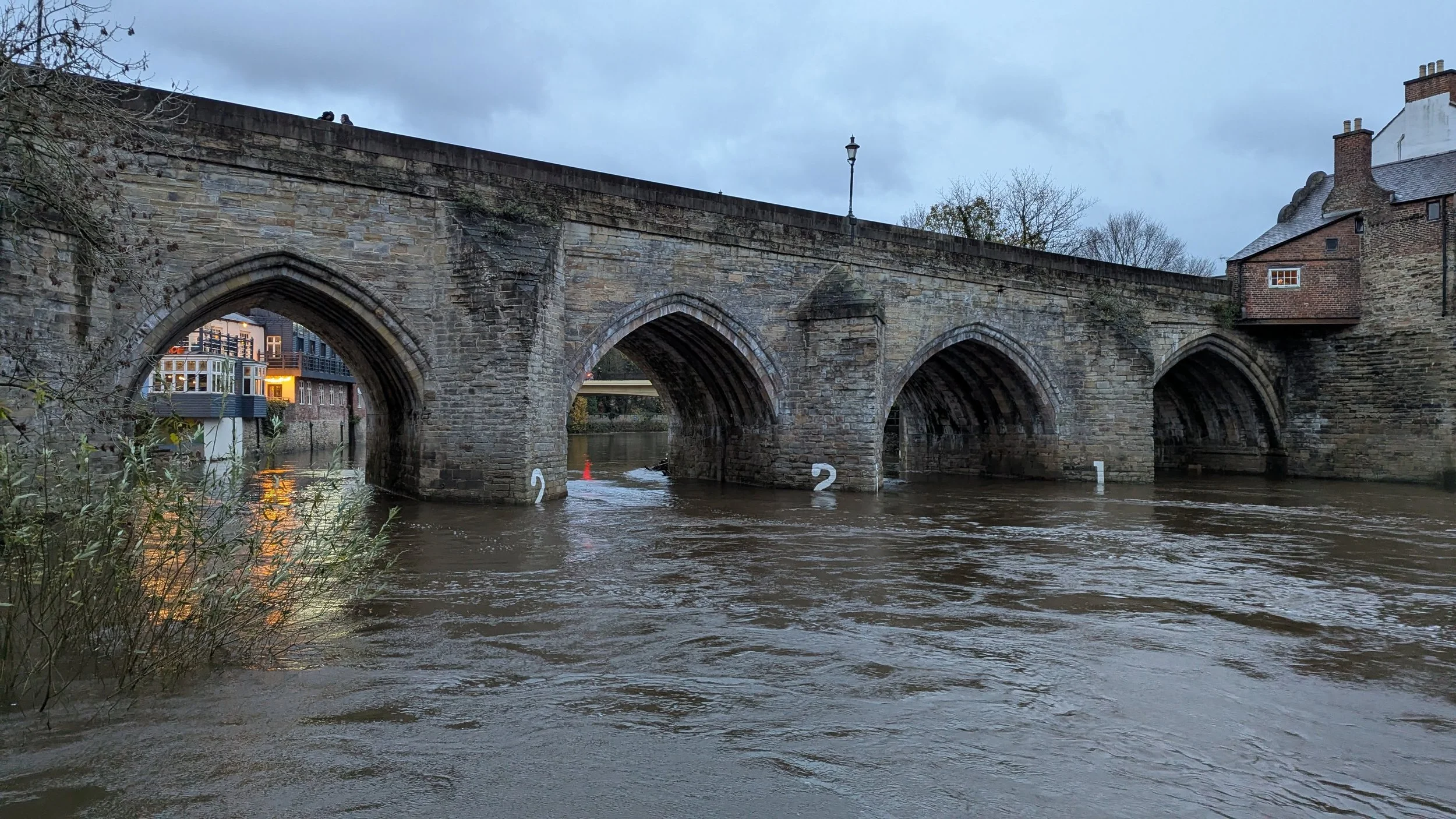
Flood waters rising up over the white painted numbers on Elvet Bridge
Framwellgate Bridge: Durham’s Oldest Crossing
Framwellgate Bridge is Durham’s oldest surviving bridge, first built in the early 12th century under Bishop Ralph Flambard. It formed the main northern gateway into the city, linking the peninsula to Crossgate and the Great North Road beyond.
In the Middle Ages, the bridge was a place of business and defence as much as movement. It carried buildings, shops, and a gatehouse, making it a tightly controlled choke point. After severe flood damage, it was rebuilt in the early 15th century and later widened in the 19th century.
Despite all this change, Framwellgate Bridge still funnels movement directly into Durham’s historic heart, although as a pedestrian only route — just as it has done for nearly 900 years.
The name derives from the ancient Fram Well Head, a spring which was connected to the Market Place by pipes in 1450.
Prebends Bridge: Georgian Elegance and Romantic Views
By the late 18th century, bridges were expected to be beautiful as well as functional. Prebends Bridge, built between 1772 and 1778, was designed by George Nicholson for the Dean and Chapter of Durham Cathedral.
Replacing a footbridge destroyed in the flood of 1771, Prebends Bridge was conceived as a private, ceremonial approach to the Cathedral precinct. Its three graceful arches were positioned to frame one of Durham’s most famous views, with tree planting used to complete the Romantic landscape. Durham Pointers often suggest that visitors walk along the riverbanks to Prebends bridge to enjoy the view and read the quote from Walter Scott carved into the end of the bridge.
Today it is Grade I listed and forms part of the Durham Castle and Cathedral UNESCO World Heritage Site.
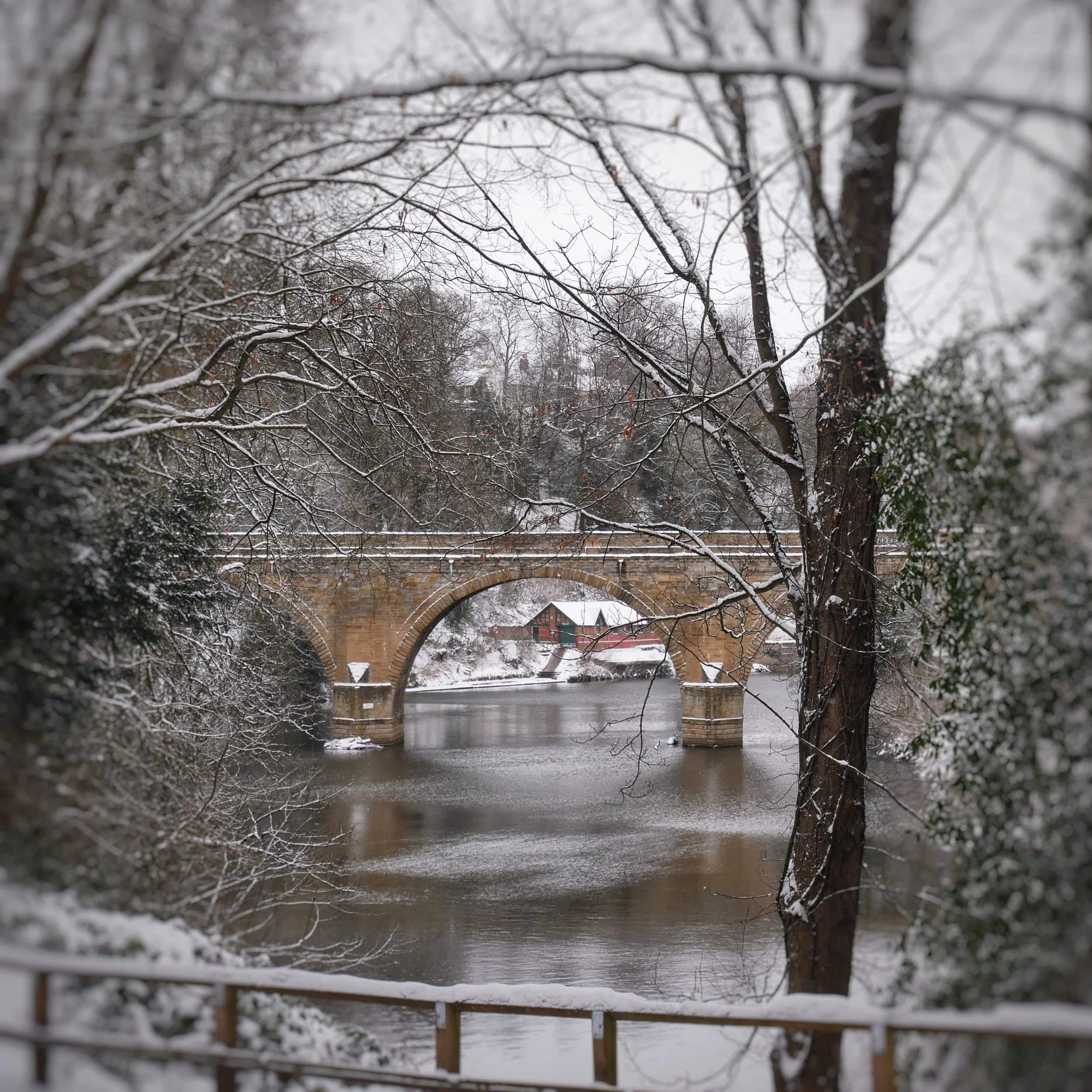
A snowy view of the river and Prebends Bridge
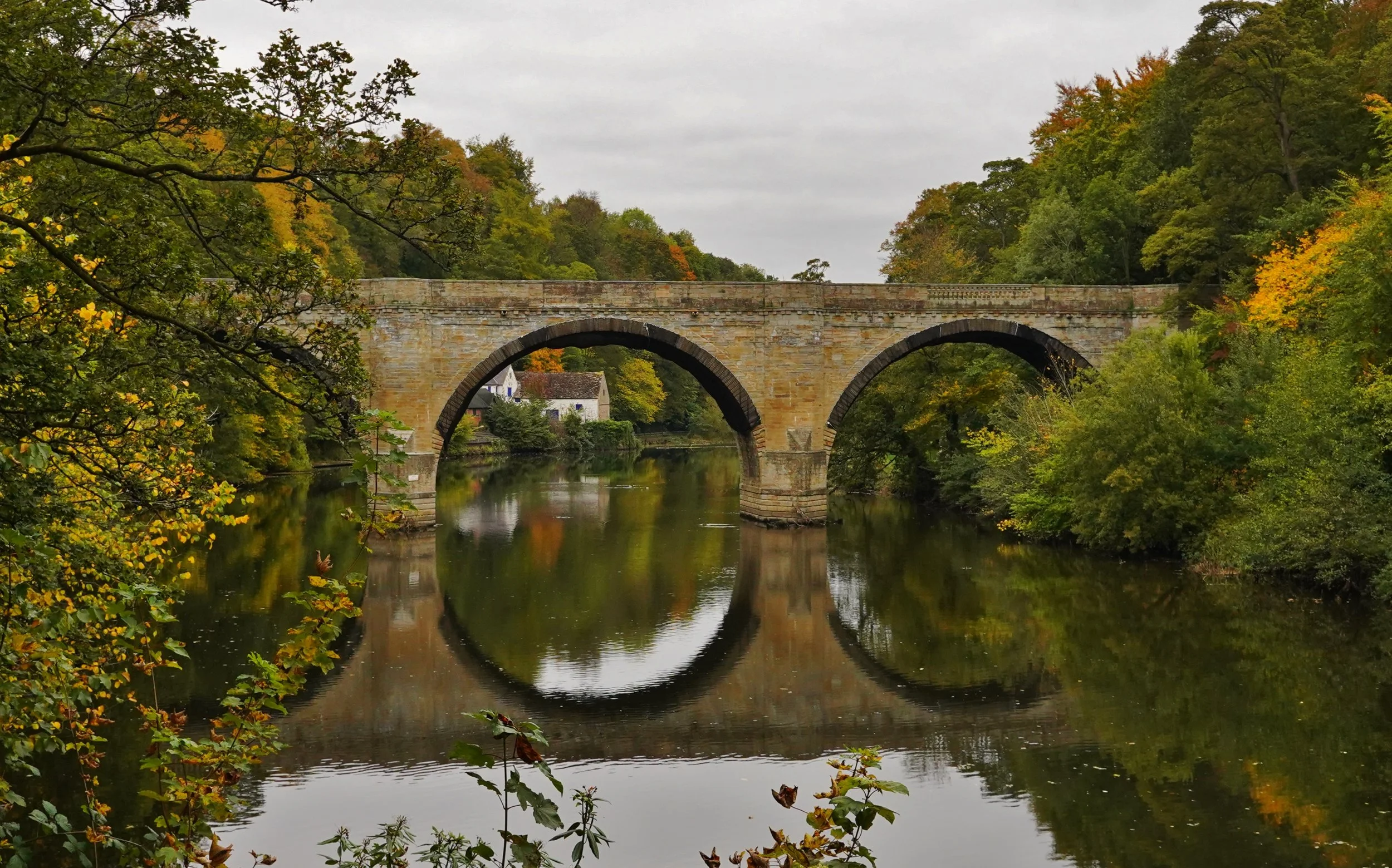
A perfect reflection of Prebends Bridge in the waters of the River Wear
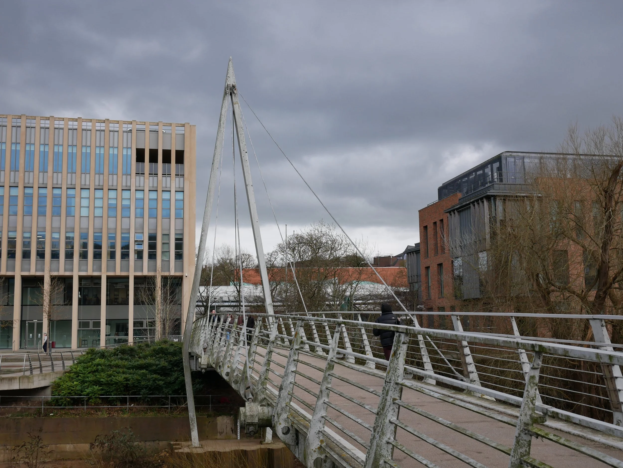
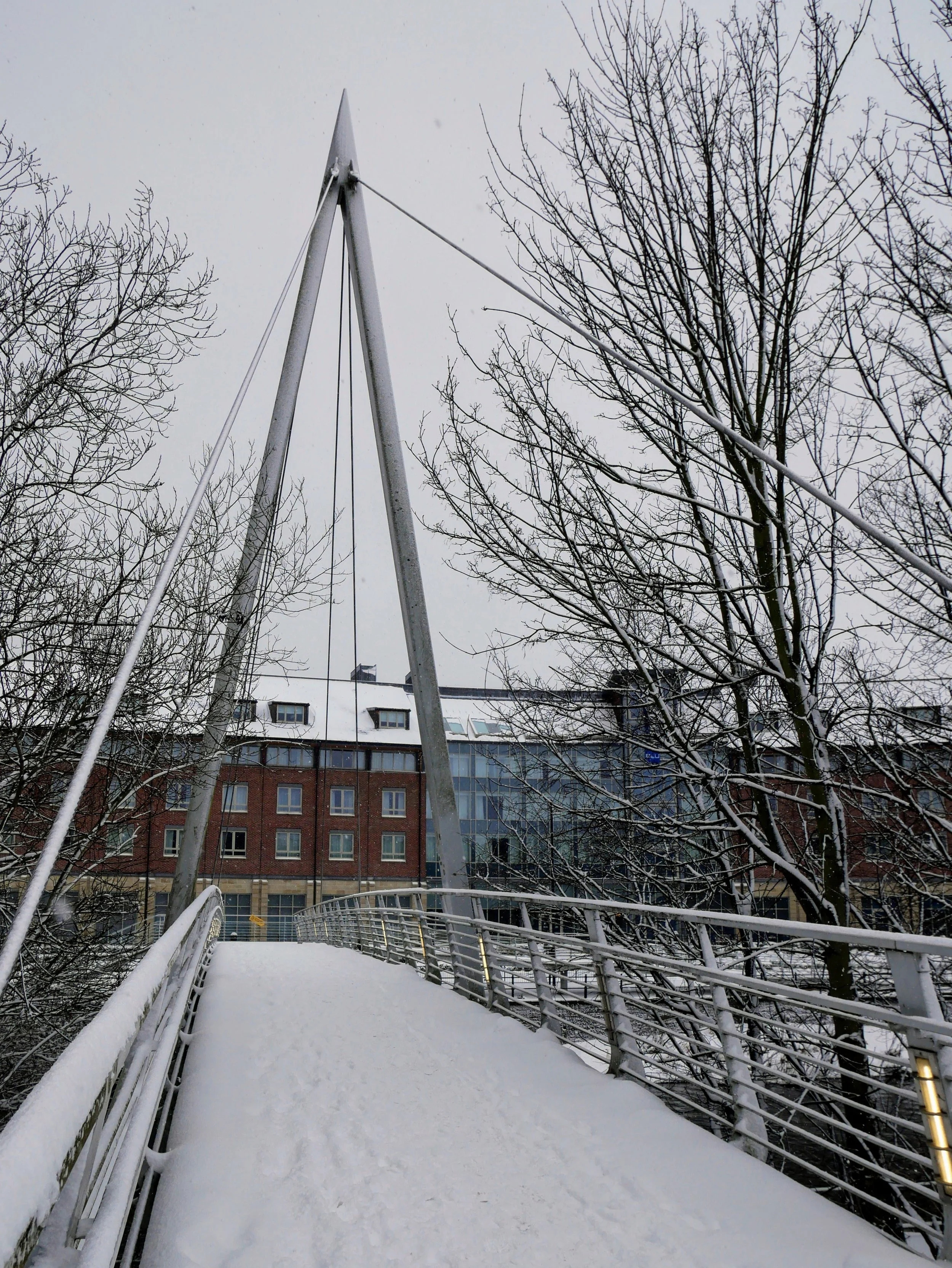
Kingsgate Bridge: Modernism Over the Medieval River
Durham’s boldest architectural statement is Kingsgate Bridge, a reinforced concrete footbridge completed in 1963 and personally designed by world renowned structural engineer Ove Arup.
Linking Bow Lane on the peninsula with the University’s Student Union building, Dunelm House, the bridge was constructed by casting its two halves on opposite banks and rotating them through 90 degrees to meet above the river — an innovative solution that avoided major disruption to the Wear. If you look sideways at the expansion joints in the centre of the bridge you can distinguish a T (for town) and a U (for university)
Now Grade I listed, Kingsgate Bridge is widely regarded as one of Britain’s most important post war bridges.
The name Kingsgate comes from a story about William the Conqueror's visit to Durham in 1072. According to the legend, William doubted the fact that St Cuthbert's body had not decomposed, and ordered his coffin to be opened. Before this could be done, the king was struck by a fever, and afraid that he had offended the saint, fled Durham from this point, never to return.
A view along the length of Kingsgate Bridge, looking towards Dunelm House

Looking under Kingsgate Bridge to the brutalist architecture of Dunelm House
Penny Ferry Bridge: Reconnecting the Riverside
Penny Ferry Bridge is a pedestrian and cycle bridge opened in 2002 as part of Durham’s Millennium City regeneration, which also included the Gala Theatre. It provides an important modern link between the city centre, riverside paths, and nearby hotels.
Originally proposed as the Millennium Bridge, it was renamed Penny Ferry Bridge following public consultation. The name recalls the small ferry that once crossed the Wear at this point, costing travellers a penny.
The bridge is a steel suspension / cable stayed structure, designed exclusively for non motorised use. While modest in scale, it plays a key role in encouraging walking and cycling along the river and reconnecting areas previously separated by road infrastructure.
The local gaggle of geese can often be seen relaxing and raising their young just under the bridge.
Pennyferry Bridge
Pennyferry Bridge in snow
Milburngate Bridge: Engineering the Modern City
The busiest crossing in Durham is Milburngate Bridge, a concrete road bridge carrying the A690 across the River Wear. It was opened in 1967 as part of a comprehensive traffic relief scheme.
Designed to divert heavy traffic away from Durham’s medieval bridges, Milburngate Bridge is a balanced cantilever structure built from reinforced concrete and supported on two river piers. Its construction marked a decisive shift toward modern traffic engineering.
The bridge was integrated into wider redevelopment, with the original Millburngate shopping centre built alongside it as part of a coordinated modernisation of this gateway into the city. After decades of heavy use, the bridge has undergone major refurbishment and remains a crucial part of Durham’s road network.
A view across a weir to Milburngate Bridge
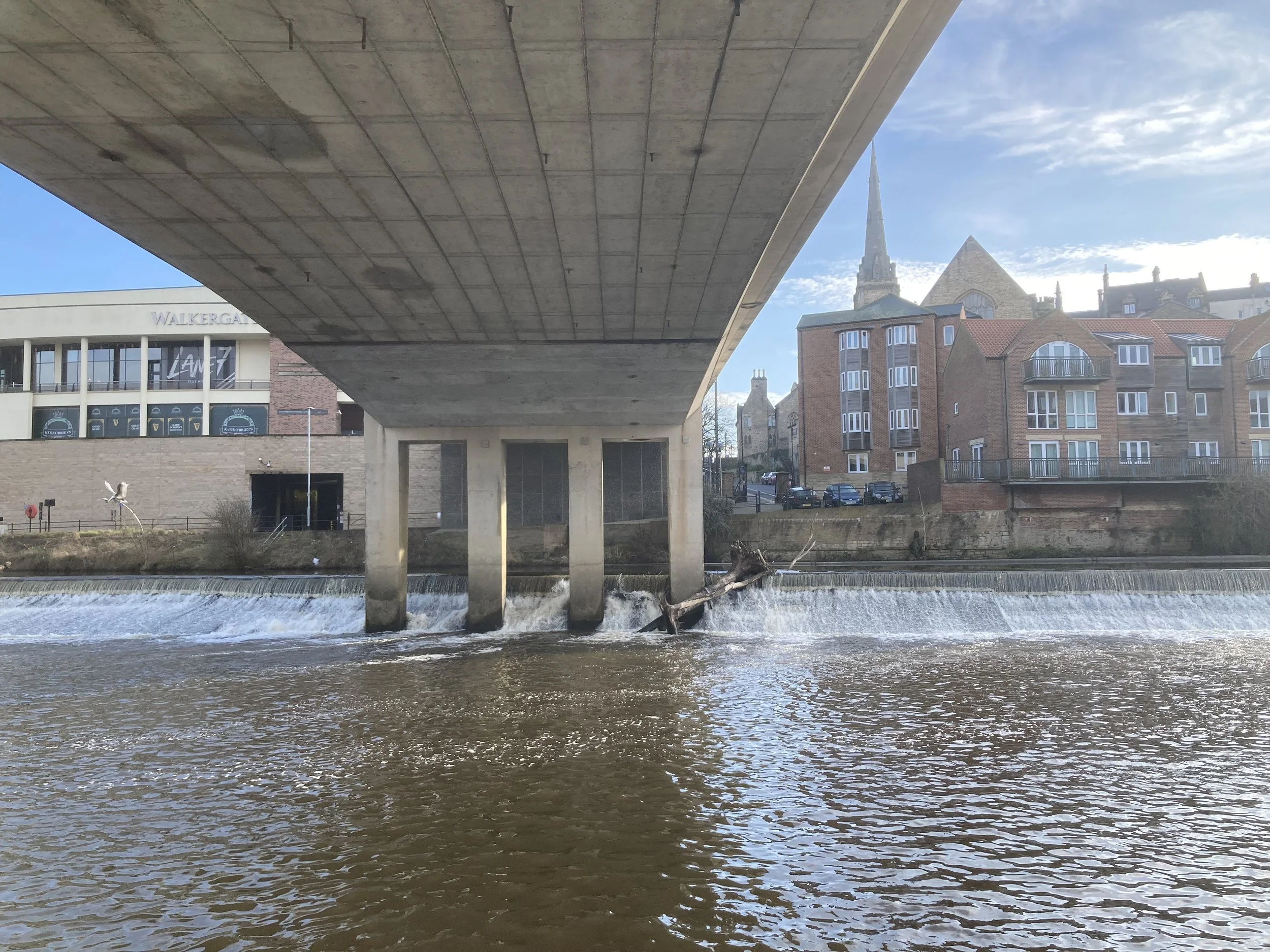
A view of the underside of Milburngate Bridge
New Elvet Bridge: Managing Traffic at Scale
New Elvet Bridge, also known as Elvet Road Bridge, opened in 1975 as the second phase of Durham’s traffic relief strategy.
Designed by John Tully of Durham County Council, it is a balanced cantilever concrete bridge carrying large volumes of traffic while bypassing the medieval core. Together with Milburngate Bridge, it forms a west–east corridor that protects Durham’s historic bridges from heavy vehicle use.
A Timeline of Durham’s Bridges
• c.1127 – Framwellgate Bridge first built
• c.1160 – Construction begins on Elvet Bridge
• 13th century – Completion of most Elvet Bridge arches
• Early 15th century – Framwellgate Bridge rebuilt
• 1771 – Great Flood destroyed or damaged multiple bridges
• 1772–1778 – Prebends Bridge constructed
• c. 1805 – Elvet and Framwellgate Bridges widened
• 1855 – First Baths Bridge built (wooden)
• 1898 – Baths Bridge rebuilt in iron
• 1962 – Current Baths Bridge opens
• 1963 – Kingsgate Bridge opens
• 1967 – Milburngate Bridge opens
• 1975 – New Elvet Bridge opens
• 2002 – Penny Ferry Bridge opens
• 2020s – Major refurbishment and renewal projects
Elvet Road Bridge from the upstream side
Baths Bridge: A Footbridge for the People
Baths Bridge reflects Durham’s social and recreational life rather than commerce or defence. A crossing has existed here since 1855, originally serving the public baths and washhouses on Elvet Waterside.
The current structure dates from 1962 and is a reinforced concrete pedestrian bridge with a single elegant arch. It is closely associated with Durham Regatta, once carrying the regatta’s commentary box and remaining one of the best viewing points along the river.
After more than 60 years of use, Baths Bridge is now scheduled for replacement in 2027, ensuring the future of this well loved crossing.

Baths Bridge
A City Told Through Its Bridges
Durham did not replace its bridges — it layered them. Each generation solved the same challenge differently: medieval bishops built fortified crossings, Georgians framed views, modern engineers diverted traffic, and today’s city prioritises walking, cycling, and heritage.
Medieval bridges cluster closest to the historic core. Modern footbridges create pedestrian commuting and recreation routes reconnecting riverside paths. Road bridges divert traffic away from the peninsula.
In Durham, crossing the River Wear is never just about getting from one bank to the other; it is a journey through time.
Final Thoughts
It’s easy to walk around the city and see all these bridges. See our Walks page for riverside walks or call at our trike to pick up one of our own walks leaflets. Download our map to locate all the bridges. For more ideas, see our Days out from Durham and Things to do in Durham City guides.
Adam has been a Durham Pointer for nine years. As a retired engineer he enjoys learning about the different structures in the city.